July 2020
After 4 months of madness in a New York City transformed by Covid, we escaped, headed to Seattle to visit Bruce. We wanted fresh air, walks in wild places. We dug in being the virus epicentre in March/April; morgue trucks parked outside the local hospital, sirens a constant backdrop. We stayed in, like everyone, shocked by the global unfolding of the virus. We supported the protests, but not the burning of police vehicles 5 minutes from our door. 4 weeks of circling helicopters then fireworks; a contest of canon sized rockets echoing from the buildings. Humidity hit mid July and we gave in. Covid has ripped the livelihoods from millions. We knew we were lucky; Dave has his job, his office closed, he can work from anywhere.
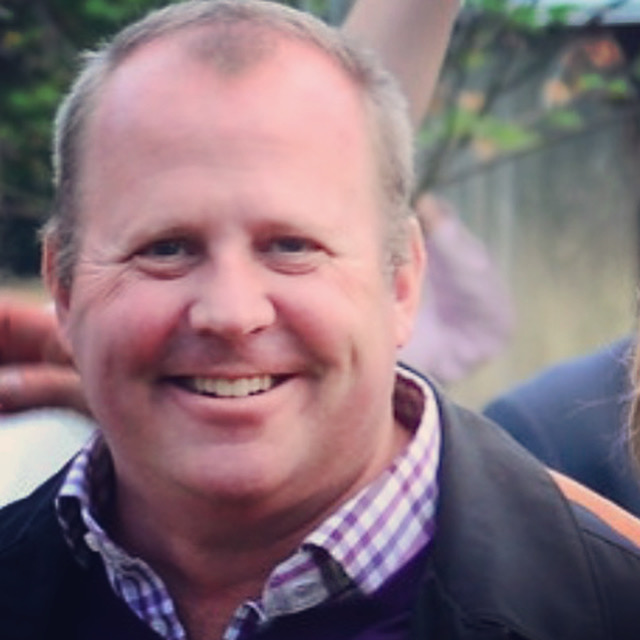
We hadn’t seen Bruce for 12 years. I first met him in 1991 when I was living in Nebbi Uganda, a remote bush community in East Africa. Bruce was riding a bicycle solo across Africa. His arrival in the bush was surreal; the roads were rough, the locals unused to cycling foreigners and the list was long of wildlife that could have eaten him. Fast forward 1991 to 2020. At JFK airport surreal scenes of Asian passengers in hazmat suits, a biblical tableau in a deserted airport. Our Delta flight honoured social distancing and masks; we sat amongst 19 empty plane seats. Fast security checks, boarding and un-boarding; we’d be as likely to catch Covid buying groceries as we would flying 5 hours to Seattle.

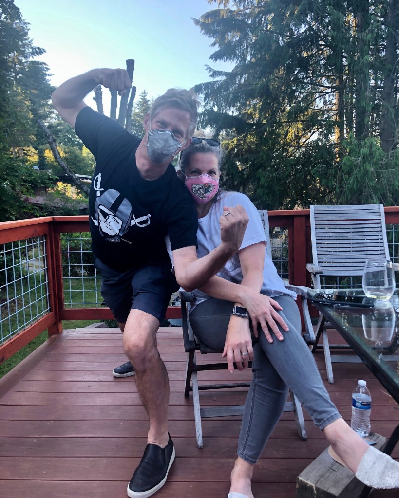
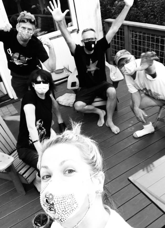
Bruce, masked up, met us from the airport. An early flight so we were on his deck by 11am. Aside from our regular emails, we had 12 years to catch up on. The neighbourhood looked the same but with an old friend and neighbour Peggy recently passed away age 96; we raised a glass and looked to her house. Within hours our friends Evan and Amy had driven over with a bottle of champagne; they sat across from us on the deck and the stress of New York started to peel away.
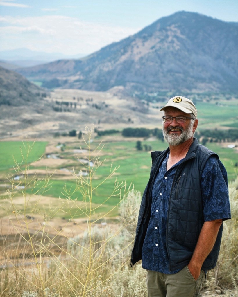
Camping in Eastern Washington. Dave had to work but Bruce, knowing I wanted to go camping took time off, loaded up his Jeep Cherokee with sleeping bags, 2 tents, ground mats, a cool box and all the stuff he was used to hauling on and off the road from his many trips in to the mountains. We hit the road for 2 nights in the wild.
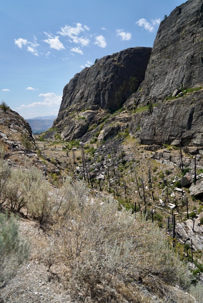
We took the I-90 to Ellensburg and headed south through Yakima Canyon. Already the scenery was stunning, populated with fir and pine trees towering towards a cloudless sky. We drove on through Yakima, stopping briefly at an Arco station to fill up, an area suffering from a spike in Covid; Bruce pleasantly surprised to see everyone wearing masks. From Yakima to Union Gap and then on to the park roads in the Ahtanum State Forest. This working forest covers an area of over 75,000 acres, used for lumber as well as recreation, with numerous campsites, facilities and a Green Dot Road system which marks trails for vehicles. Due to the Covid outbreak in Yakima County, the campsites were closed and strict ‘no fires’ notices displayed; the ground was sun-scorched…tinder dry. We weren’t looking for campsites, we were looking for flat ground in a wild place away from people.

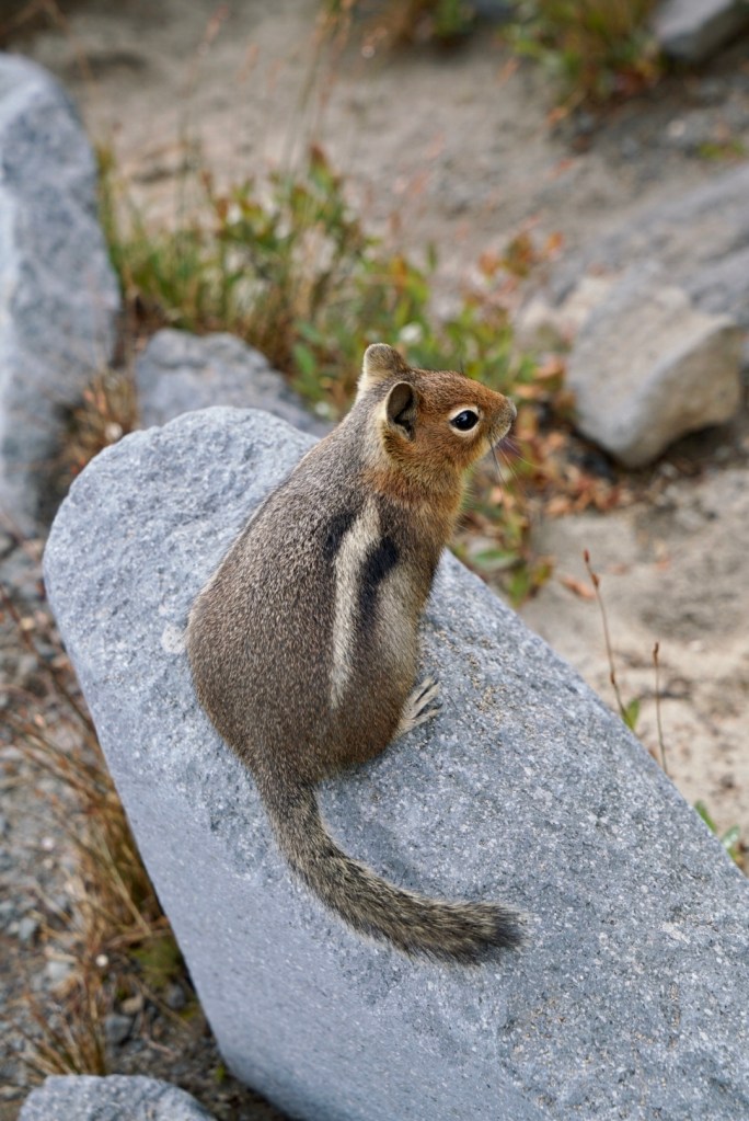
Driving up a steep rocky road we reached Eagle’s Nest Lookout with views across a forested valley. With binoculars we searched for birds, we could hear calls echoing across the valley but couldn’t spot any. Another winding rocky road back down passing Clover Flats campground then driving up Divide Ridge, flattening out higher to an area covered with a burn…. hundreds of stripped trees, burned back to ashy white trunks, spindly, some curving partially uprooted, the ground littered with wood but fresh growth showing. We stopped again to watch birds, Bruce getting out the scope so we could get a closer look at a juvenile Red Naped Sapsucker sitting with its belly flat to a tree.

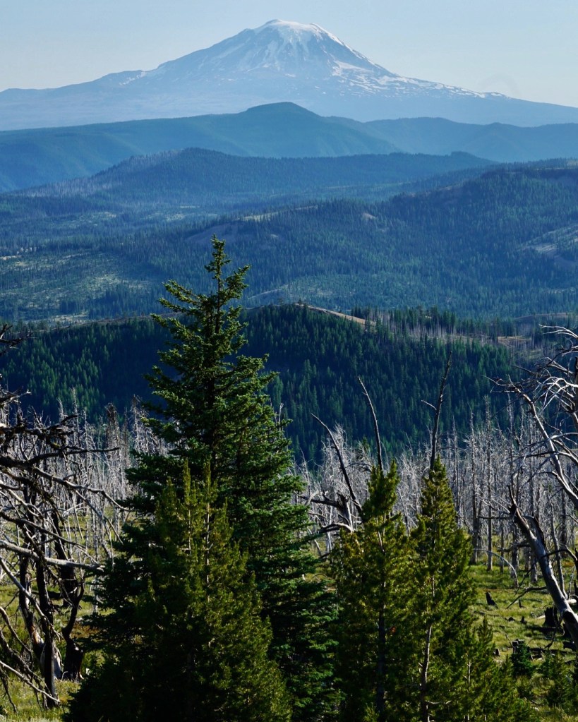
On to the top of Darland Mountain, 6,985 feet above sea level. Closed for a good 6 months of the year due to snow and impassable roads, we had fantastic mountain views of the Cascade Range.
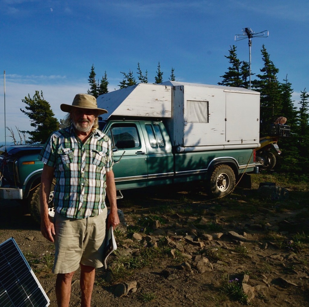
Surprisingly we met someone else at the top of Darland. We hadn’t passed any vehicles for several hours, but settling in for the night was Mountain Top Mike as I nicknamed him. He’d taken his hand-built home off his old truck and moved it on to his 1980s long wheel base pickup, with his TV antenna perched on top and his solar panels laid out, he looked well set up. He told us about the US Military training flights in Rainbow Canyon, Death Valley, known as the ‘Death Valley Jets’. Some fly below you through a gorge known as ‘Star Wars Canyon’. Mike told us the police had been up to ask him to move on as it wasn’t permitted to camp, but he didn’t look to be going anywhere and the sun was starting to drop. He gave us advice on a trail to follow down the other side which could lead us to places to pitch our tents. We kept a good distance from each other aware of Covid advice but he gladly posed for a photo. Not many times you meet someone atop a mountain.
A 4WD Jeep Cherokee with adjustable suspension and an experienced driver can handle these roads, I doubt Mountain Top Mike could make it carrying all the extra weight and width. Bruce and I rocked from side to side checking the Jeep’s grade and tilt screen… laughing as it recorded the percentage tip of the vehicle, hoping to hit higher numbers. The road down, loose and rocky with deep washed out potholes, a challenge; my stomach pitched and roiled like a washing machine. Fun but I felt we were chasing the sun and I wanted to get set up before night stole the daylight.

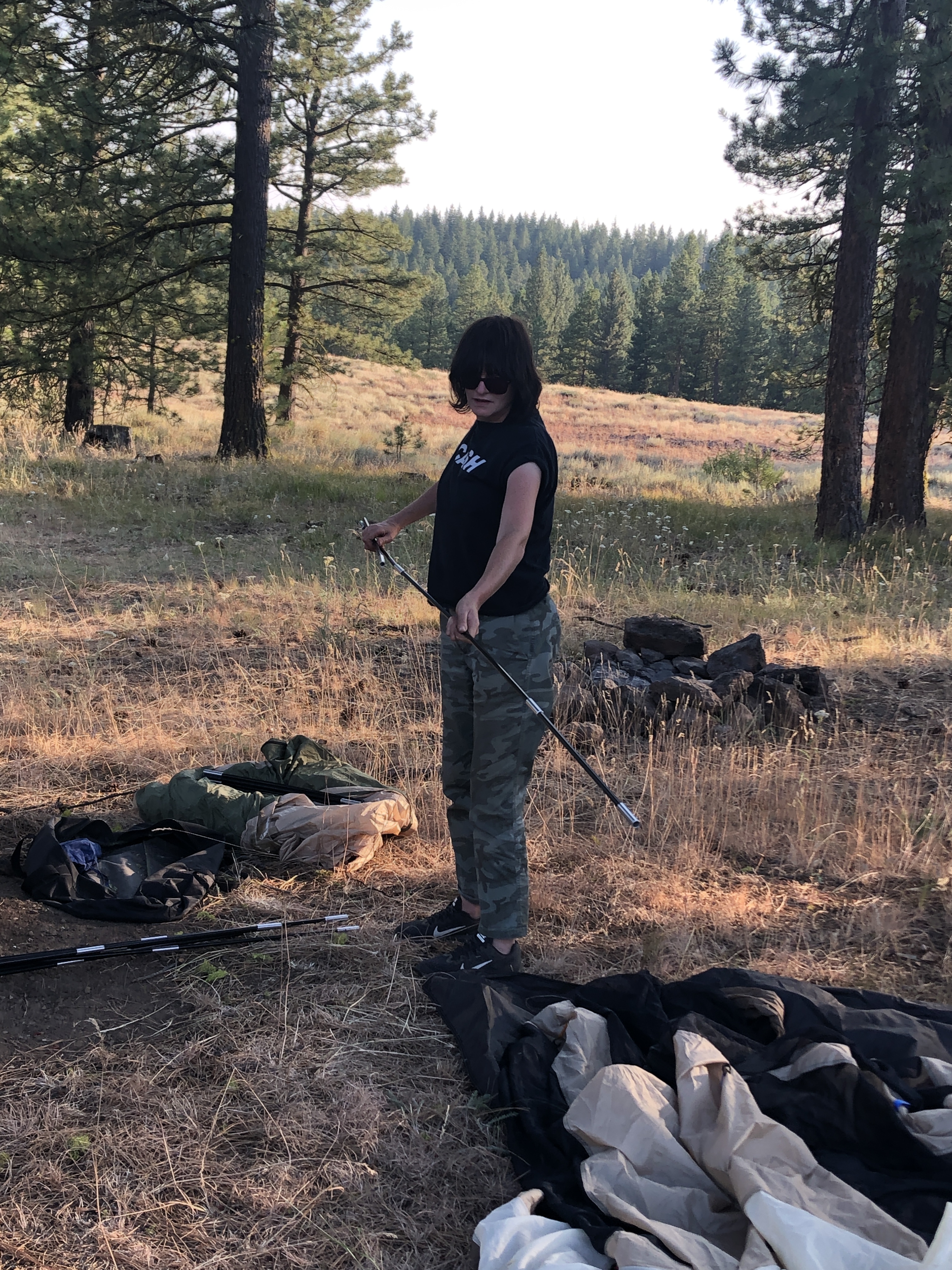
Not far down we spotted a steep rock spur, leading off the trail, at the top a beautiful flat meadow sheltered by huge trees. It was my first time pitching a tent, Bruce an incredibly patient teacher showing me how to match up the coloured cords from the groundsheet to matching cords on the tent. The folded supports looked like those joke magician wands we had as kids….slotted together, flexed and threaded and clipped with a few pegs added to secure, it only took 20 minutes. Bruce loaned me his larger tent for my first ‘proper’ wild camp. I could stand upright…handy for putting one’s trousers on but with the added frisson of knowing that with my crap balance a wobble to the left or right would demolish my sleeping quarters in seconds.


Our spot was perfect. We got out the camping stove and gas bottle, the folding table and chairs, made sure we knew where the ‘shit shovel’ and toilet roll was, ate a simple meal cooked up by Bruce then called it for the night, heading off in the pitch black to our respective digs. I had just enough clothes draped over my down sleeping bag to get me through. Middle of summer but the middle of night is bloody cold this high up. I lay on my inflatable ground mat looking up at the stars through the vent in the roof of my tent, ignorant to their names, listening for owls, drifting in to sleep.

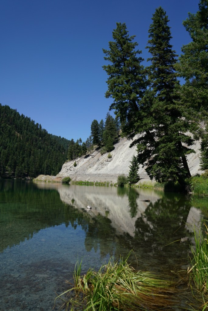
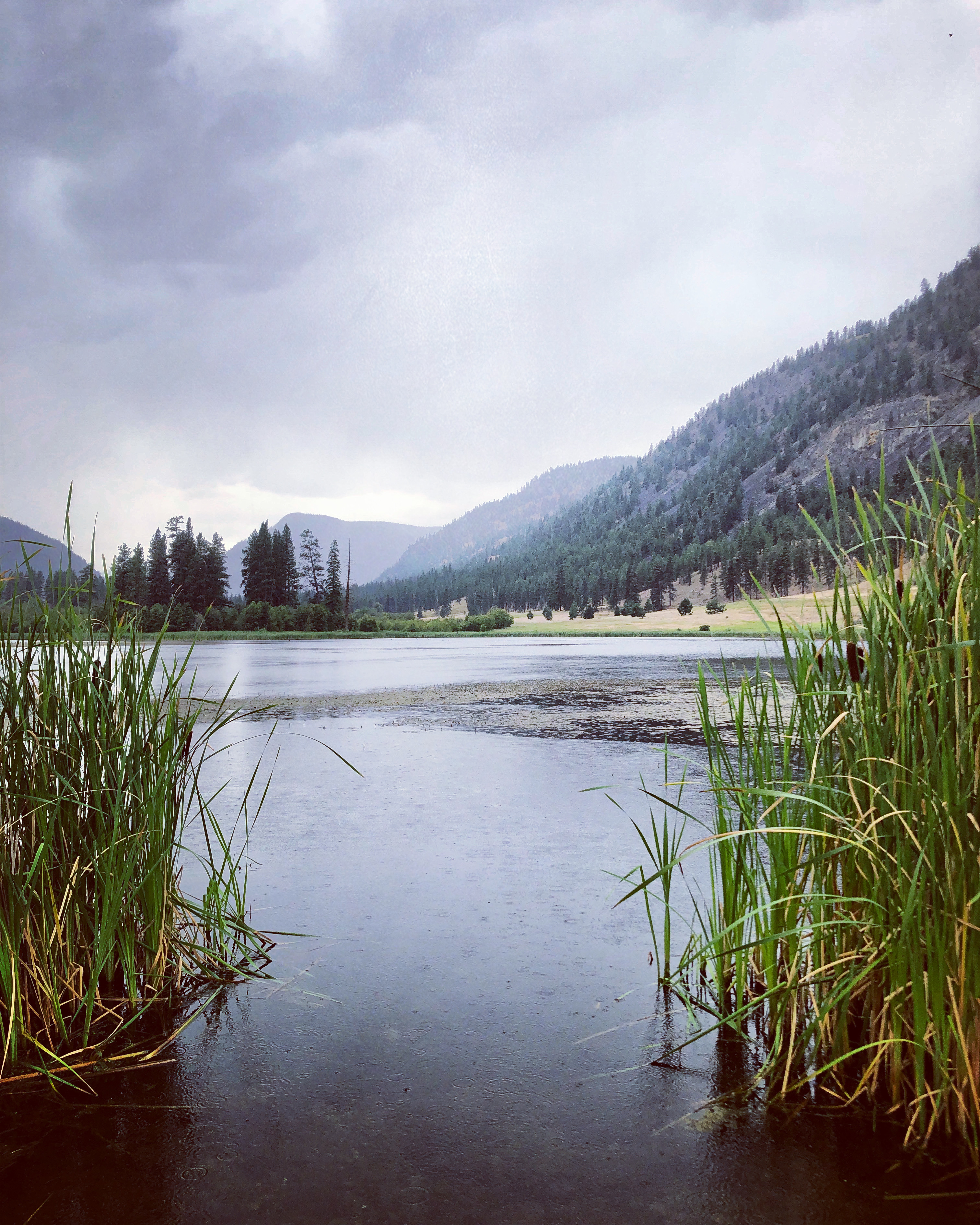
The next morning we ate breakfast and wandered to look for birds. A bright yellow Western Tanagier, Pine Siskins, Chipping Sparrows, Mountain Chickadees and Dark Eyed Juncos flitted through trees. We watched over a bubbling stream for Dippers, only seeing their droppings on rocks. Plenty of birds but little in the way of birdsong. The pasture was full of wildflowers; Alpine Lupins and Yarrow…a beautiful peaceful spot. We packed up the tents and hit the road, Bruce pushing his Jeep up roads washed out by snow melt. We tried to drive through South Fork Tieton River in the Wenatchee National Forest but couldn’t get through, some roads blocked off. We bumped and rolled down steep trails, jumping out to clear large boulders, finding a small lake.
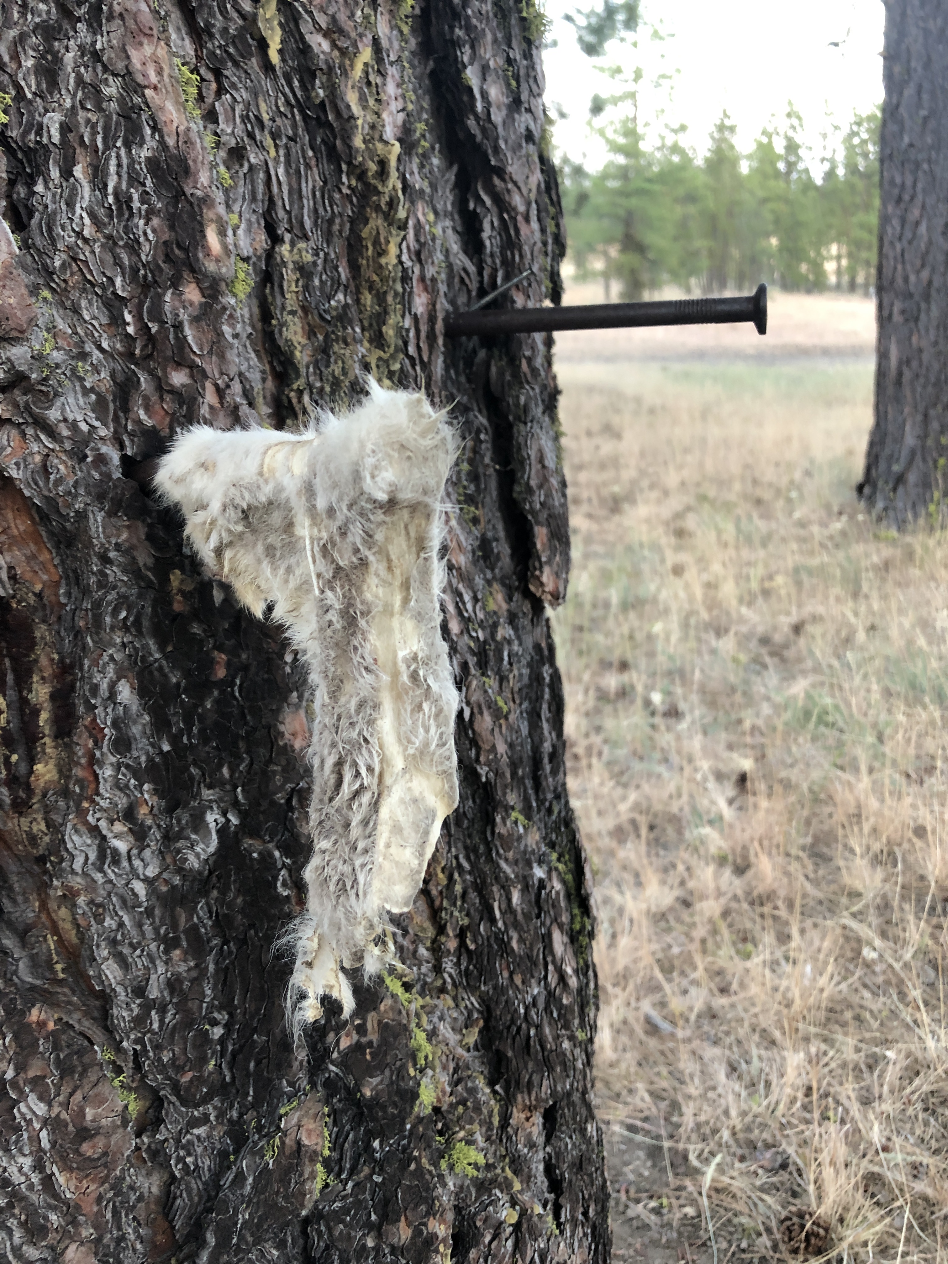
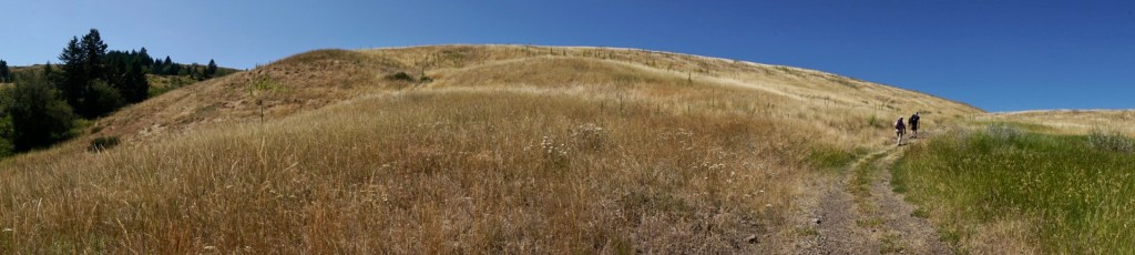
We were trying to find a trail to Green Lake but found more closed off roads and ended up looping back on ourselves…with scenery this beautiful getting a bit turned around doesn’t matter. Back to Union Gap and on to the I-82 to the I-90 and beyond Ellensburg, we got on to the Coleman Canyon Road, taking a spur road further up on into the Colockum until we found flat ground for our second night in the tents. Bruce said it was perfect; I pondered as I noted the animal skull hung from a branch, spent shotgun shells, a deer butchering post and a slither of animal skin nailed to a tree. Like a friend commented on seeing the photos….”it all looks a bit Blair Witch Project.” It was close to the loose dusty road we’d driven up but like Bruce pointed out, “How many other people have we seen all day?” None.
Our spot had obviously been used by hunters, most likely last October during hunting season. A large fire ring of stones and spent ashes taunted me; I’d been looking forward to nights round a camp fire toasting jammy dough sticks but again the area was tinder dry, the ground cover crackled as we walked on it.


Thousands of pine cones were scattered under the trees, the smallest cones covered in barbs. I cleared as many as possible before laying out the ground sheet, I didn’t want to risk it getting shredded. We walked the dusty road to see Wolf Lichen, a shrubby branched fungus which clung to the trees glowing yellow green in the lowering sun. I looked it up; apparently toxic to mammals and used historically as a poison for foxes and wolves, it’s Latin name appropriately listed as Letharia Vulpina.
Chunks of Ponderosa Pine bark scattered the ground. known to be a heavy wood, its bark has distinctive broad plates mapped with black crevices. They can grow to towering heights; a 268 foot tall Ponderosa was measured with a laser in Oregon in 2011. It’s a bewitching sight to look across a forest of Ponderosa Pines as the sun lowers lighting their trunks in a red-orange glow. I kept a piece to inspire a future art project.


I managed to pitch the tent on my own once I’d cleared the ground, and feeling proud of myself headed off in to the trees armed with the shit shovel to be one with nature…stumbling forward as I attempted to stand from my crouched position and landing my hands in two perfectly formed piles of Elk shit…at least it wasn’t my own. I had become a little obsessed with random turds…speculating if they were left by bear or coyotes. Going back to our camp I found a giant cow pat right by the tent so I prised it from the grass lobbing it across the clearing. Bruce didn’t pitch his tent, opting instead to sleep on his inflatable ground mat under the trees. It was a much warmer evening at considerably lower elevation than the night before; the susuration of a soft wind rustling tree tops, bending tall grasses.
I woke at 6am. Bruce already awake watching the birds. He’d heard Nightjars and Owls, I’d slept soundly, 8 hours straight missing everything. So much for being worried about bears. Packing up, battling to fold the table in to a concertina, loading the Jeep we left. Pulled in to pasture to see what birds we could spot. A large fire ring with huge charred logs, beer cans blistered in ash, shell casings…another butchering post. Hunting crap left behind; we practised leave no trace. We wound down Coleman Canyon Road to another closed off road. They can be closed by a locked gate or permanently closed with large mounds of earth over-planted to create flower strewn hillocks. Down Coleman Creek Road we stopped in the canyon. A stream below us, rock slides had uprooted and splintered trees. Bruce looking for Canyon Wrens, playing their bird call through a tiny speaker. We heard one calling back but couldn’t spot it. A lot of other birds, we wandered the road with binoculars. My favourite, a pretty White Headed Nuthatch.
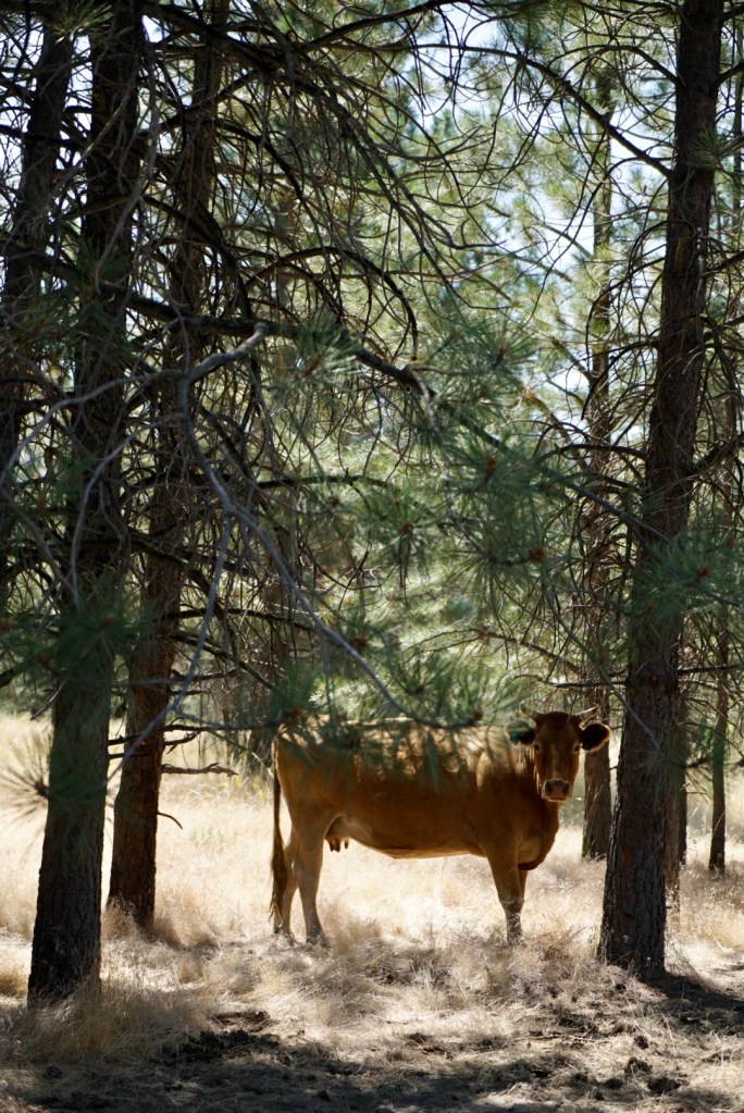
Another rutted trail bounced the Jeep. On to Colockum Road, up over Colockum Pass, an area Bruce hadn’t explored and I doubt many vehicles could reach. Trees with their lower branches lopped to slow down wildfires. Unmanageable fires obviously an issue but natural fires benefit the forests; burning off years of fallen branches littering the forest floor and thinning the straggly young trees which make the forest too dense; the resulting ash a nutrient for the soil. Further along Colockum it opened to pasture, cowpats evidence that this was a great grazing area for domestic roaming cows. A perfect spot for a picnic lunch.


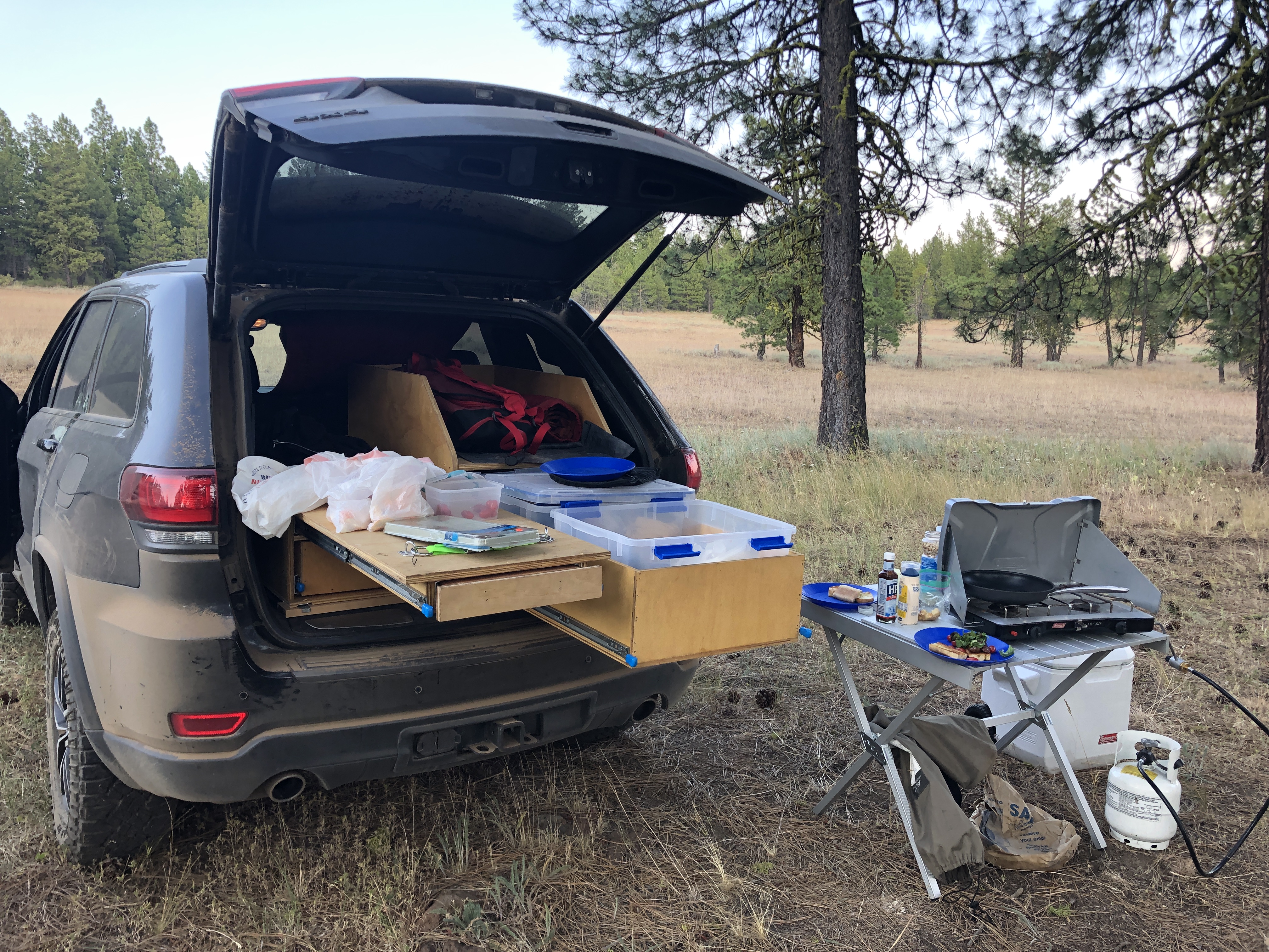
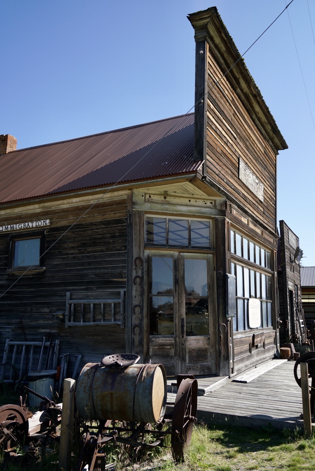
Bruce has customised his Jeep; better storage and access to his camping gear. He’s built slide out drawers and chopping board a flat area to strap in the cool box. We unloaded the scope, made sandwiches and sat among cowpats contentedly watched the birds. Leaving our idyllic spot we passed a carved granite marker for the site of the Halfway Station on the immigrant route dated 1887. Imagine riding these roads on mules, dragging wagons and covered caravans when rain would churn mud and hide rocks. Notices show hunters the difference between Wolves (protected) and Coyotes (fair game). I stooped to examine two long turds (2 nights camping and I think I’m a tracker) which Bruce convinced me could be wolf or coyote. Fascinated by the proximity of the exotic (we don’t get coyotes in the UK) I picked up a turd, a beetle scuttled away. Taking a photo which Bruce later showed to a friend who can identify this stuff. I’d picked up dog shit.


Camping trip over but a scenic route back to Seattle. We followed the Columbia River, driving through Wenatchee, stopping off in Cashmere for a BBQ lunch, masks on for the first time in a few days to go inside to order…eating outside at picnic benches, saving half for Dave’s dinner. Through the fake Swiss town Leavenworth with its alpine styled buildings… cars crammed the parking spaces, crowded despite the virus. On to Stephen’s Pass with a stop to look over Tumwater Canyon then a straight route back.
August 2020 Aeneas Valley Cabin Trip
1st August. Back in Seattle for two days before we hit the road again. Dave had holiday to use from work so we rented a couple of cabins through AirB&B in Okanogan County near the Canadian border, the first one for 5 nights in the Aeneas Valley and the second in Conconully. With a 5 hour drive ahead of us, we headed for Highway 20, Bruce pulling over at the site of the tragic 2014 Oso landslide. A huge chunk of unstable hillside collapsed, creating a mudslide that engulfed the small neighbourhood of Steelhead Haven. Covering around one square mile it killed 43 people and destroyed 49 homes and buildings. 43 cedars were planted as a memorial; decorated with photos, toys and small tokens…faces of the dead including children, smiling out from treasured family photos.

Driving further, we stop to look at the stunning turquoise water of Diablo Lake, actually a reservoir in the North Cascades. The jade green colour is created by Skagit gneiss, a rock containing the mineral olivine. When eroded by ice it flows down glacial streams in to Diablo Lake. The sun reflects from the tiny rock particles illuminating the colour. It’s a popular destination for kayakers and trail walkers. Further along we looked out over the Skagit River Gorge.

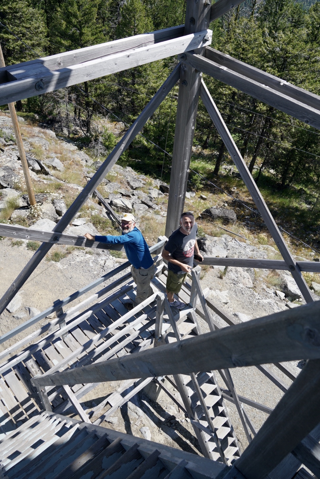
A view from Highway 20; Dave and Bruce looking out across Washington Pass in the North Cascades.

Driving through the town of Twisp where by coincidence Bruce’s friend and neighbour Darin was hanging out for the day (we sailed through before realising) we stopped for a late lunch at Loop Pass, stuffing our faces with butter chicken samosas bought from QFC’s deli counter (can’t get enough of them), drove around a new campground site and used a national forest privy close to a horse camp. Continuing on Highway 20 we drove through Okanogan, eventually picking up the Aeneas Valley road… now in a rural area of open fields we looked for the small dusty road which turned off to our first cabin.
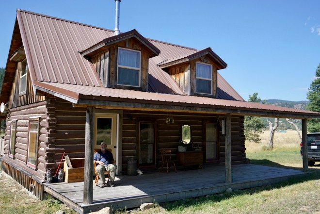
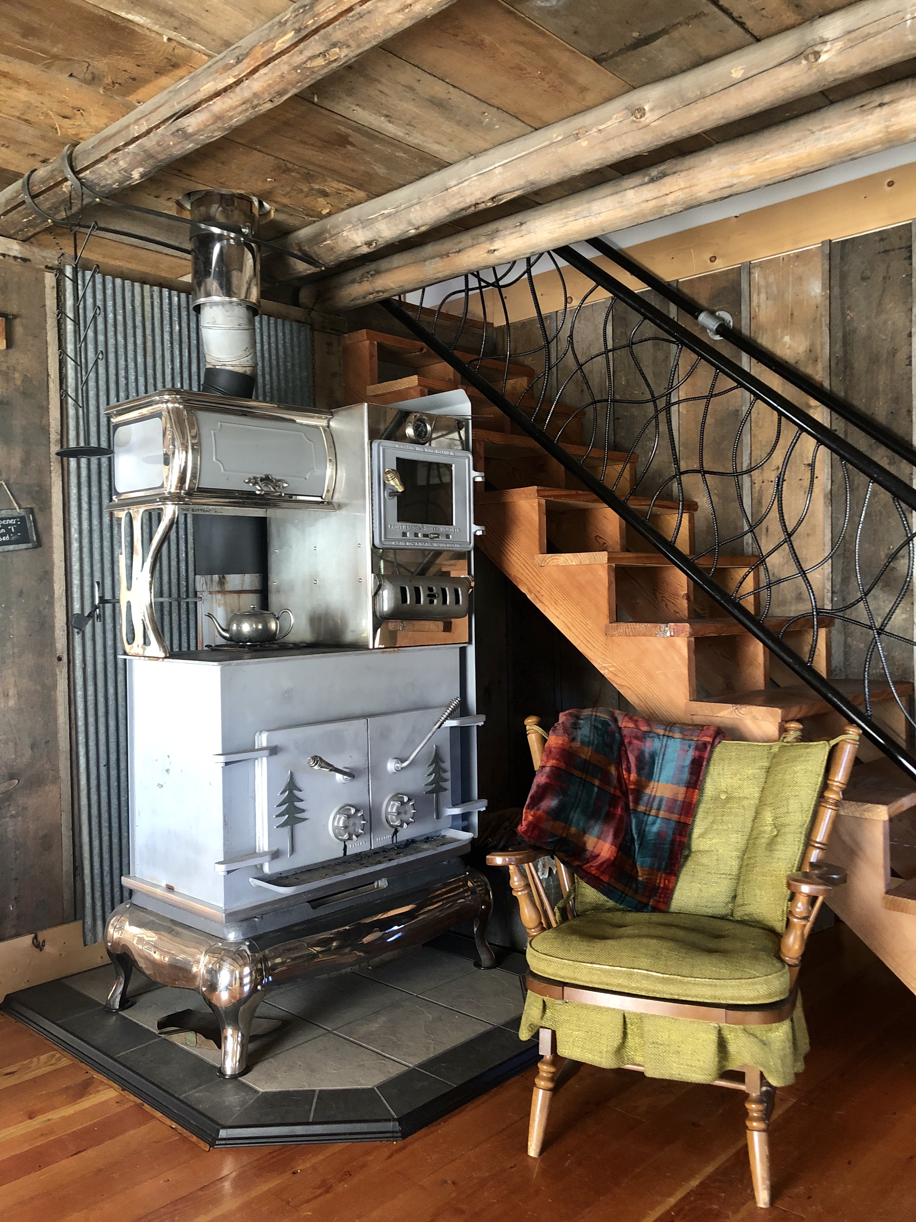
The Old Stump Ranch blew us away. Based near Tonasket, standing in an open field, it’s an original cabin which the owners bought, dismantled and moved to their own land where they had it rebuilt. The attention to detail; antique furnishings, handmade quilts, a beautiful old stove…a labour of love. We couldn’t believe our luck. If you’re looking for a cabin in Tonasket this place is a genuine treat https://www.airbnb.com/rooms/42667602?source_impression_id=p3_1598550512_Zk%2BZQy%2FwMrQkYCo8


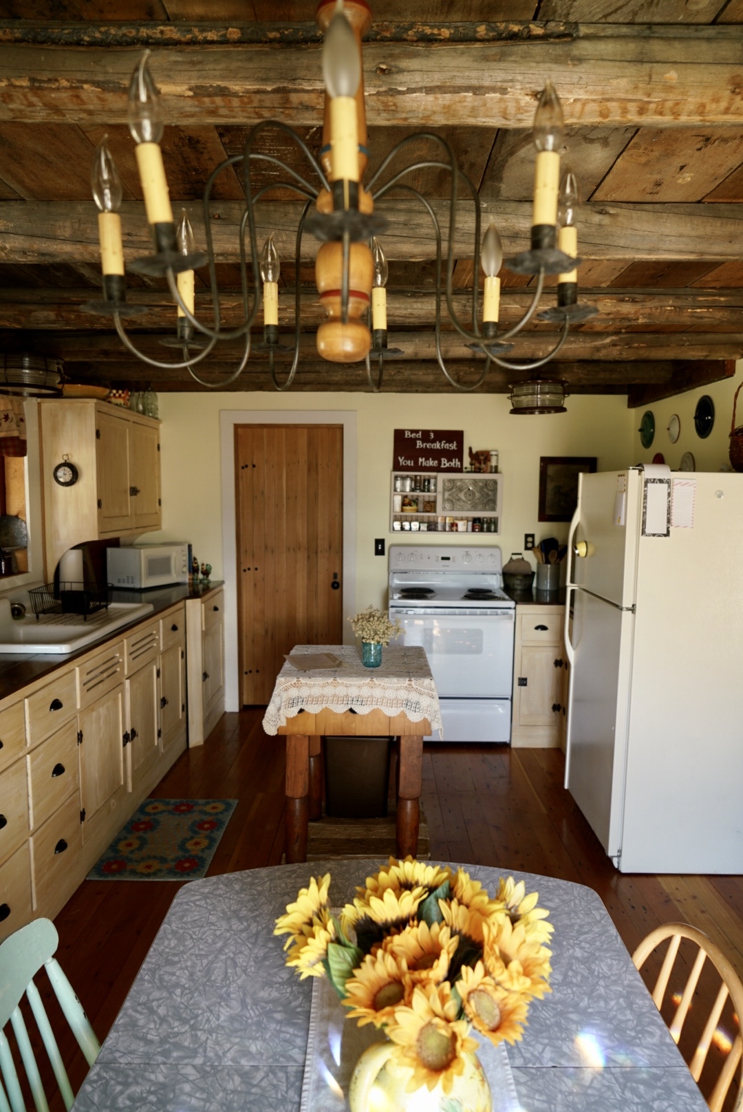
With 3 bedrooms, we took an upstairs bedroom and Bruce took the one downstairs. We unloaded all of our food, loading the cupboards and fridge….the plan being to avoid trips to the grocery store because of reported Covid 19 spikes in the area. I cooked and we sat on the deck all evening to eat, chat and watch the sun set. The temperature dropped a little and we turned in for an early night.
2nd August. The following morning, breakfast out on the porch, the sun blazing on a golden field with a view across to the forest, we decided to chill out and hang on the deck; read, relax. We sat by idly in rocking chairs as a farmer worked across the field in a tractor, ‘pooping out bales” as Bruce called it…a bucolic scene set in a quiet landscape. The only sounds were the tractor baler beeping each time a fresh bale was ejected and the hummingbirds buzzing to and from the feeder. One hummingbird in particular so viciously territorial, he made a tiny blur as he constantly dived and flew at the other four. He even went for me when I wandered close. Obviously used to visitors they were remarkably tame, not moving when we walked right up to them. A soft wind blew across the deck as we lazed away the day, fighting the urge to doze off and after dinner we were treated with an incredible rising orange moon, climbing up behind the tree line, huge and glowing it looked more like a sunrise. We turned in to the sound of coyotes yipping.

3rd August. The next morning I wandered over to the field next door to see the llamas. The neighbour Kenny was out with his three dogs, he warned me to high-step through the long grass keeping to the cleared parts in case of rattlesnakes. When I reached the wire fence, he warned me about his neighbour’s rescued llamas who had a tendency to spit. Kenny’s dogs were inquisitive but experienced and wary…but Bailey, excited by the presence of a new person, shoved her head through the fence wagging her entire body, licking any part of me she could reach. I admired Kenny’s immaculately built log privy (outdoor toilet) circled by wind-chimes and windmills. It reminded me of the Grandfather in ‘Chitty Chitty Bang Bang’ when he used to march out with great ceremony to his wooden privy. After chatting I high stepped it back to the cabin where I was dive-bombed again by the Machiavellian hummingbird. Death by rattlesnake or llama, possibly understandable, maimed by a bird as big as my thumbnail….embarrassing. He has become my nemesis.

With Bruce behind the wheel we set out to explore. Our first stop the Tunk Mountain Lookout. Set on the highest point of just over 6,000 feet elevation, the original was built in 1933 and features on the National Lookout Historic Registry….this structure a rebuild in 1966 if internet research is correct. At around 40 feet tall we climbed part way up the timber structure, it’s blocked off after the first main landing. Abandoned several years ago as a Lookout it’s now privately owned. Sweeping views and hundreds of alpine flowers and grasses grow between lichen covered rocks. An informative website gives more details and directions: http://www.willhiteweb.com/washington_fire_lookouts/tunk_mountain/lookout_104.htm
We drove through more areas of forest fires from the previous year, acres of silvered trees and burned branches, new growth pushing through. Deer stood stock still to observe us before bounding for cover. As high as we climbed in the Jeep, cows still surprised us by wandering out of the forest in to the road, leaping back to join the herd. A surreal presence in this setting.
And a rare treat, Bruce spotted a Snow Shoe Hare which we watched for a minute before it disappeared in to shrub. At Talkire Lake, we took out binoculars to see Northern Harriers, an Eastern Kingbird, Coots and Ruddy Ducks; acres of dark grasses waving in the foreground. We drove on to McLaughlin Canyon, the 1858 site of an American Indian ambush on miners heading north to the British Columbia gold fields. An ever increasing number of miners passed through this way disrupting the life of the native people. The caravan of miners retreated and crossed the Okanogan River on rafts the day after the ambush. Bruce bird watched, seeing a Lewis’s Woodpecker and a small group of Chukars picking their way through the rocks.
A truck was behind us on the way down, slowly towing a car on the winding steep road, kicking up dust as it passed. We ate sandwiches sitting on roadside boulders under a blistered tree, treading cautiously for rattlesnakes, peeling thick juicy oranges with the juice running down our chins. Back in the Jeep, back to the Aeneas Valley and our last stop for the day, Crawfish Lake. We sat on picnic benches watching a marmot dart in and out of its burrow located under the National Forestry toilets. I rolled up my trousers, paddled in the lake to photograph the skinny iridescent blue dragonflies…darting between reeds. The melancholy call of Loons drifted to us across the water.
4th August. We set out along the Cape Labelle Road through the forest and on to the Okanogan Highlands to Wakounda….wasn’t that the fictional city of Black Panther? Open grassland, a wonderful collapsing barn and a community hall with an outdoor privy. Ground squirrels skittered in to the grass as a Golden Eagle soared above us. We stopped by Beaver Lake surrounded by trees, its gem coloured water reflecting in the sunlight…a beautiful swimming spot if I ‘d thought to bring my swimsuit. Further along the shore kids jumped from a tree hung rope swing, cannon-balling in to the water. A young girl lay stretched out sunbathing, oblivious to her legs sticking out in to the road.
On to the small town of Chesaw, its rodeo cancelled for the first time in over 60 years because of Covid. The town thrived in a goldrush which was over in just a few years and was named after a Chinese settler called Chee Saw, who arrived in the 1890s. We parked on a ridge near a barn above Chesaw where Bruce knew of a trail up to Strawberry Lake. It was baking hot, midday, the sun burning down on our heads. As we walked past a house owned by WDFW, horses grazing the garden, 3 dogs came bowling out barking, and the horses lumbered in to our path. We didn’t stop to see if the dogs were friendly but kept on going, brushing through dandelions that glinted as though full of tiny mirrors, dancing in the sun. Wildflowers sprawled the path, jeep trails flattened the grass in parts, a deer whispered through a small copse of trees.
We rested in tree shade, startling a deer with an impressive rack of antlers which leapt over the ridge behind us. We ate sandwiches and peeled oranges, watched for birds. An hour later the steep trail, heat and fierce sun proved too much for me, so we decided to give it up…too hot to keep going, walking back down to the dogs. A woman was tending to the horses, the dogs calmed by her presence nudged at our legs…one was blind and looked just like Bruce’s old dog Bella, similar markings but smaller. Bella was deaf and blind in one eye.


Molson, an historic homestead preserved as an open-air museum known as Old Molson Ghost Town, was recommended to us by our friend Darin. Pioneer buildings, farming equipment, tools, artifacts and old photographs offer a glimpse back to life here in 1900. We poked around inside the buildings, some set up to show traditional domestic settings, another an old post office or bank. Deserted we had the place to ourselves. It looked like a Wild West movie set.


Leaving Molson our route took us right along the Canadian Border, looking in to Canada grasslands across the fences, thinking of our good friends Sandra and Tony on Vancouver Island who we couldn’t visit as the borders were still closed due to the virus. So close that our phones pinged with a message from our phone providers announcing “Welcome to Canada!”. A quick stop in Oroville to fill up with petrol and reply to text messages as we’d dipped back in to cell reception, a lady in the car next to us had a tiny chihuahua peeking out of the passenger window, bug eyed it chewed on her seatbelt. Got back to the cabin and sat on the back porch picking grass seeds out of our socks, so stubby and sharp they felt like thorns.
5th August. Bruce and Dave went out for a few hours to find another Lookout Tower. Feeling lazy and wanting downtime to chill out, read and sort through hundreds of photos, I hung back at the cabin. Looking through the notes the cabin owners left us, I dug out a spiral bound book and flicked to the pages referencing Ranger Leese with some background history of the cabin we’re staying in.


6th August. To a change of location and another cabin in Conconully; we drove through Loomis and on up the Chapaka Grade for hazy views across the farming valley stretched out green and luminous below.
Further along the narrow grade we reached Chopaka Lake, a natural dead end with camping and covered picnic tables. Swallows darted in and out of a nest in the roof of the picnic table, flashes of russet red, white and black a couple of feet above us, feeding their young in the nest. Two squirrels balanced along nearby fence-wire, one nimbly navigating his route, the other more clumsy, losing his balance and flipping upside down. A large burrow was dug out of the sandy loam a few feet away. Two families were set up in tents and a camper van overlooking the lake. Rain started to patter the roof over our table, clouds moved in and hung over the water turning it from blue to grey. We attempted an off road trail covered in loose stones where Bruce knew there was an old cabin but as the rain got heavier we gave it up, heading instead to the Sinlahekin Valley and the Sinlahekin game range covering over 14,000 acres, two and a half miles south of Loomis near the Canadian Border.
We wandered a trail through grassland, shrub and wetland; through tall grasses, wildflowers and berry bushes to Fish Lake where we watched an Osprey circle above us, diving in to the water with a soft plunk to grab a fish. There’s around 8 miles of trails but with rain setting in we wandered 2 then back on the road to Conconully.
Arrived in the evening for our last 2 nights in a cabin sitting in 42 acres of private forest, not far from Omak and a couple of miles from the Conconully Reservoir. I forgot to take any photos so the images below are taken from their listing here on the Evolve Vacation Rental website: https://evolvevacationrental.com/vacation-rentals/us/wa/conconully/215505


7th August. The weather being so good we decided to have a chill out day. The cabin is okay, looks better on the website images than in real life…nowhere near as pretty or as imaginative as the place we’d just left, smaller and more expensive though it’s setting is fantastic. Standing in a cleared section of the forest where they’ve created a beautiful lawn, watered by a buried sprinkler system which popped up out of the grass on a timer catching us out as we lounged outside at breakfast…playing musical chairs moving each time we got a surprise soaking. The picnic table in the photos is ditched and rotting in the forest and the interior dated and unloved….but views from the back in to the trees are soothing. We went for a walk through the forest and down the main road, bird-spotting as we wandered, getting phone reception nearer to the town. It’s a pretty area but we didn’t venture in to Conconully… campsites were busy and rows of RVs parked up close to each other. After the experience of New York, we were still painfully aware of the virus.

8th August. Last day of our cabin trip. Drove a meandering route back through the Palasides and the Scablands to Seattle. Following the Okanogan River, along by Lake Pateros where we picked up the Columbia River, we stopped at Grand Coulee to walk across the bridge and look over the impressive concrete gravity Grand Coulee Dam. It stands 550 feet high on the Columbia River and was built around 1933 to provide hydroelectric power and irrigation water. The creation of its reservoir, Franklin D Roosevelt Lake, resulted in over 3,000 people being relocated including Native Americans who lost their ancestral land.

On through Electric City, Coulee City, stopping to look out to Dry Falls. We detoured through some of the Channeled Scablands where we pulled over to eat at the side of the dusty road. This area is known for the ‘Great Flood’ when glacial lakes emptied across the land 2 million years ago, scouring it and creating channels through the rocky landscape. Geologically it’s fascinating and this comprehensive website has excellent images and information http://hugefloods.com/Scablands.html
We didn’t go trekking through the Scablands but followed a road between craggy dark rock-faces, some with level plateaus surrounded by lakes or looming over farm land. Elliot, an English friend of mine, worked on a documentary of the area and saw incredible aerial views from a helicopter.

Cabin trip over and back in Seattle at Bruce’s, Dave had to start work again with back to back video conference calls but at least he could sit out in the sun on the deck…his temporary office. I stuck mainly to Bruce’s Maple Leaf neighbourhood, hamstringed by not having taken my US driving test since moving here and not being allowed to drive as a resident on my UK license. Seattle is too spread out to explore by foot, something we take for granted having lived in London for 30 years and now in New York. No two houses are alike and the gardens and trees are beautiful. Dave starting work at 6.30am to coincide with his colleagues in New York, meant he was able to finish by 3pm and we’d wander the neighbourhood or up to QFC to buy food, walking over the high bridge looking down on the houses below and the crazy high trees. Sometimes we’d take the trails at the bottom of Bruce’s road; transported within footsteps from residential homes to an overgrown forest canopy, climbing steep root tangled paths, jumping across the stones in the creek, popping out the other side back in to the houses. Evan would drive over and we’d walk around Maple Leaf, down back alleys where chickens ran to greet us.


We caught up with old friends for social distanced walks, dinners, lunches in their gardens…on their decks. Not being able to hug anyone in greeting after a 12 year absence is hard. Evan and his twin boys Henry and Oliver, Amy their fab mum, Deb who’s let her hair go grey and it looks fabulous, Darin and Sherry who treated us to amazing food from their club and a pizza night on their deck, Joni and Eric, their daughters Eva and Elsa now grown up so much I wouldn’t have recognised them… and our British friends Fi and Paul (with their dogs Willow and Maya) who’ve been living here almost 3 years and are still phenomenal cooks.


We experienced a city in limbo due to the virus. We walked around Capitol Hill; CHAZ the autonomous zone now cleared other than a few remaining tents. A lot of the area still boarded up in reaction to the recent protests and street occupation but its character still not diminished. The vibrancy is currently on hold but the character hangs on in its buildings, old signs and subway art.

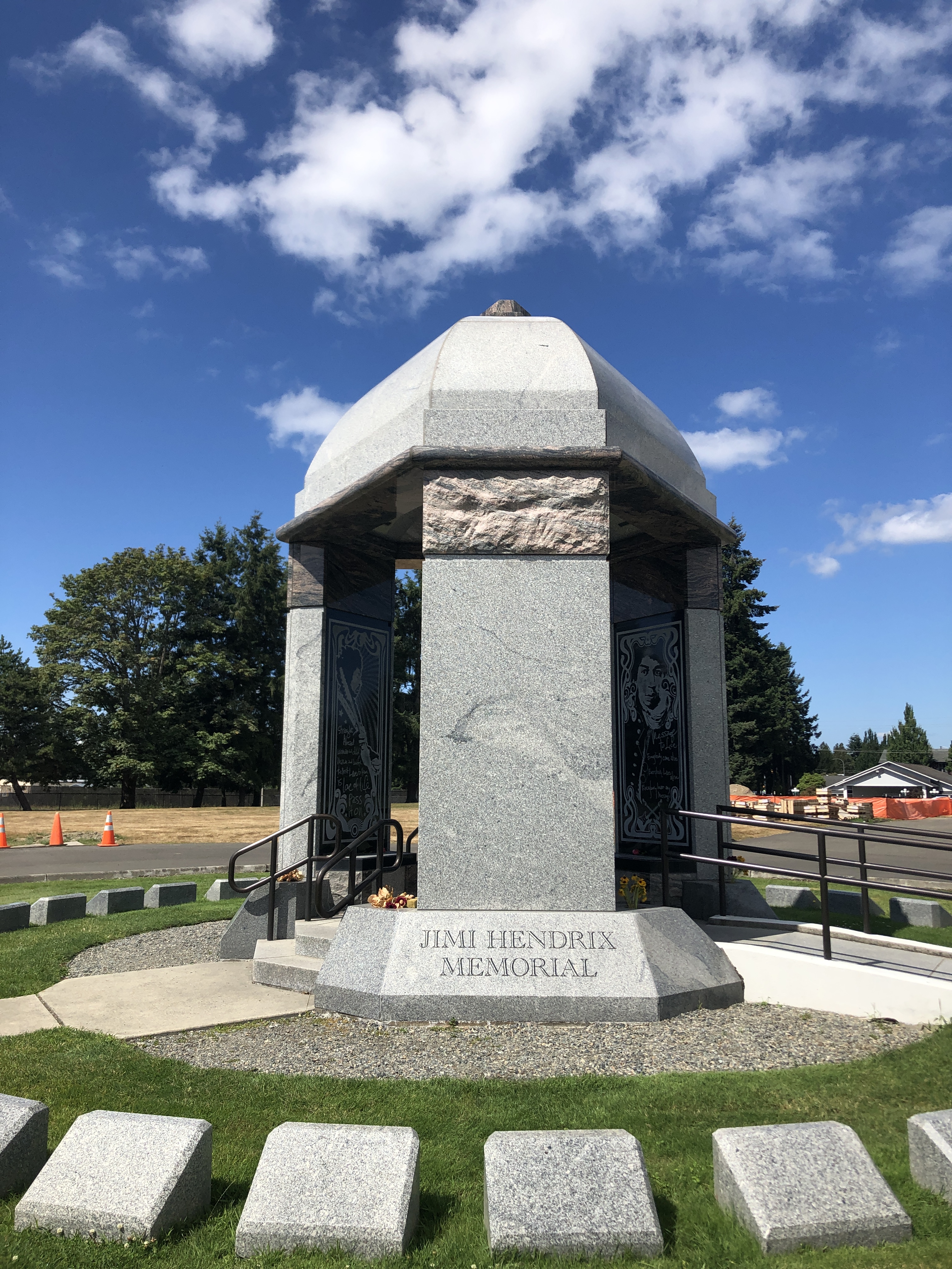
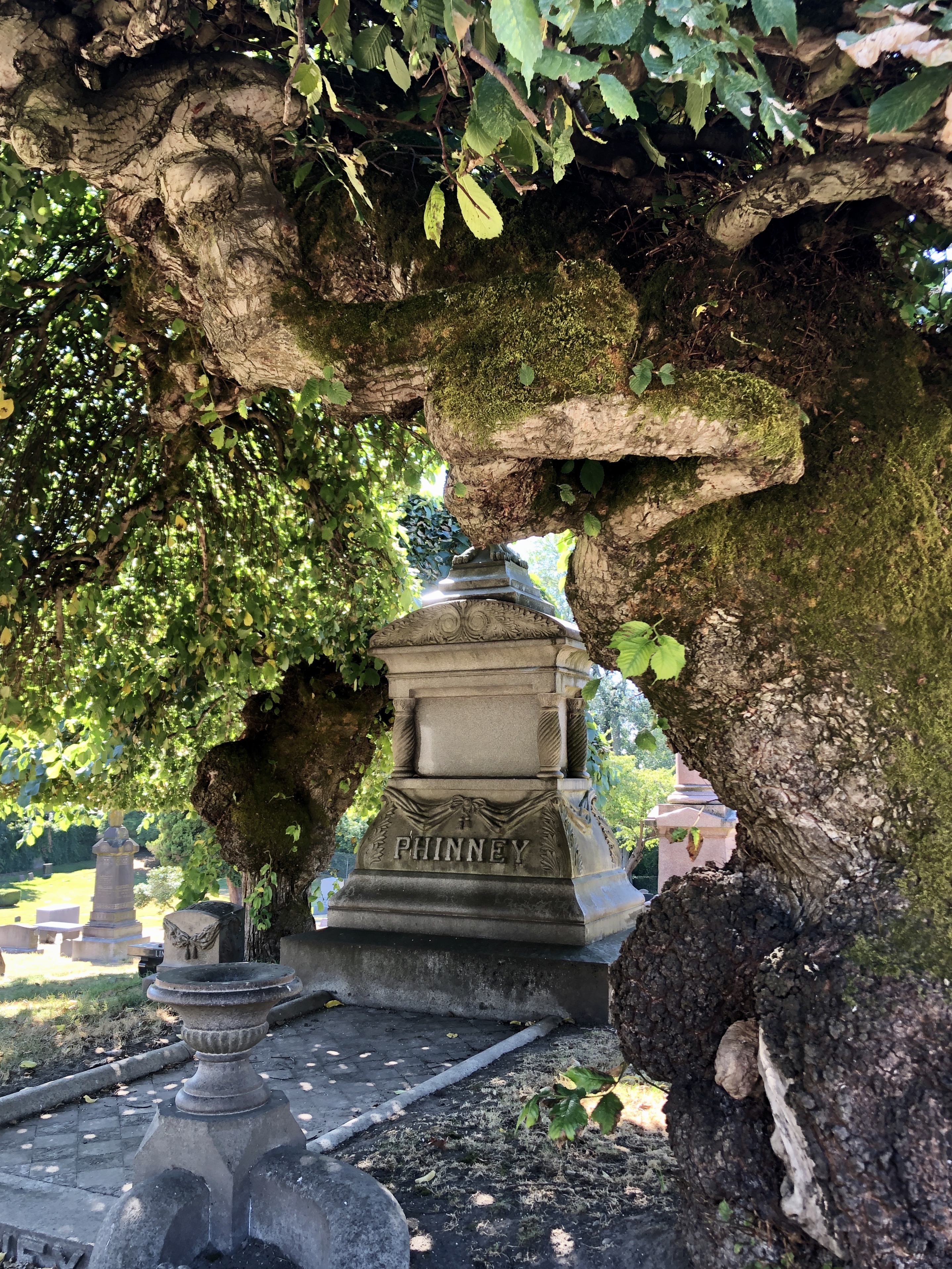
Downtown Seattle the side streets are deserted, and although there are people on the main streets, they are missing the bustle of foreign tourists. Boarded up shops and closed restaurants; the majority of people thankfully wearing masks. At the original Starbucks opposite Pike Place Market, a line of around 50 people stood like sheep, bunched close together to order a coffee. Madness. We stuck to the empty side streets which looked tired and worn, exposed without the traffic of life. A city stripped of its people is an eerie place as we’d experienced back in Manhattan. Back in the old Rav4 we drove out to Renton, visited the grave of Jimi Hendrix at Greenwood Memorial Park just outside Seattle.

On the same day we drove to Lake View Cemetery back in Capitol Hill to see the graves of Bruce Lee and his son Brandon Lee. Buried sided by side, the grave site is currently closed off with fencing as they create a path to the headstones; they get around 10,000 visitors a year. I was last here in 2000 with my old friend Angela. A beautiful place; we wandered through gnarly trees and clipped shrubs.

We hung out in Evan and Amy’s backyard sitting apart. Evan showed me how to make candy floss in their machines for Amy’s business ‘Candy Floss Boss’, sadly on a forced hold in Covid times. And Evan said “Come and see thousands of crows!” so we did and they didn’t show so we chased them when we spotted them in the sky and parked on top of the Washington University Bothell Campus car park roof and watched… amazed as thousands of crows flew in at dusk, settling on rooftops, the car park railings, on the soccer field and in the trees, their solid black bodies silhouetted by the dropping sun. The chorus of thousands of birds cawing, the noise interrupted by large flocks of 20-30 geese flying by. It was extraordinary.

We ate out almost every night on Bruce’s deck; I cooked enchiladas, meatballs and spaghetti, mango and black bean tacos…trying to come up with different meals each night with restaurants still closed. Bruce made fantastic pizzas preparing the dough the day before and we ordered in from Indian and Thai food takeaways. After dinner we would relax, read books, we watched the documentary ‘Man On Wire’ and marvelled incredulous at Philippe Petit’s fearlessness. We introduced Bruce to the English band Dr.Feelgood through the excellent music documentary ‘Oil City Confidential’. We laughed all the way through ‘In Bruges’ one of our favourite films which Bruce had never seen. Then introduced him to Brendon Gleason again in the ‘The Guard’ and Ben Kinglsey’s game-changing hardman in “Sexy Beast’. And the summer just went on and on and on so we booked another cabin and headed to Troy in Montana for a week (separate post) making the most of isolated places away from people. In Seattle the temperature cooling at night, but the sun coming out every day, so we stayed on after Montana: not wanting to rush back to the humidity of New York and Bruce not disturbed by our lingering presence in his house. And as August faded in to September we expected the weather to turn, dinners on the deck curtailed but still the sun shone and rain held off as though Autumn was on reprieve.


But our joy at this incredible weather saw the loss of several lives and thousands of trees as wild fires raged out of control in California, Orgeon and Washington States. The Okanagon area where we’d recently visited had such huge fires that we went to bed questioning the smell of smoke and awoke the next morning to a blood red sunrise, the sky wreathed with smoke which hung in trees turning the sky a peculiar phosphorous yellow. The weather, rather than turned… had been turned off. The end of summer disappeared in thickening smoke. We spent a weekend holed up indoors under advice of the city; stay in to avoid toxic fumes. Conversations dominated by global warming as the fires spread. My sister commenting: “Are you ok? You seem to be lurching from one disaster to another.”
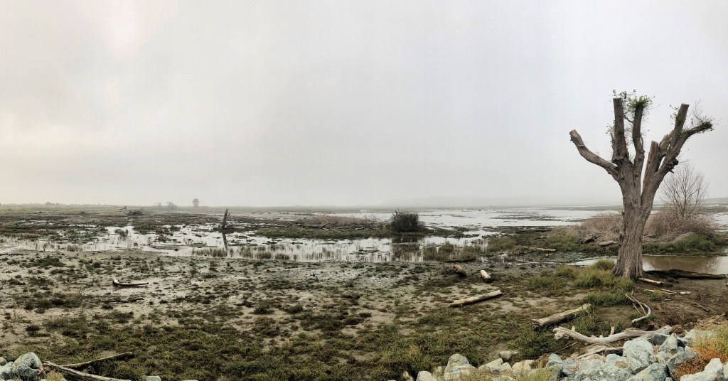
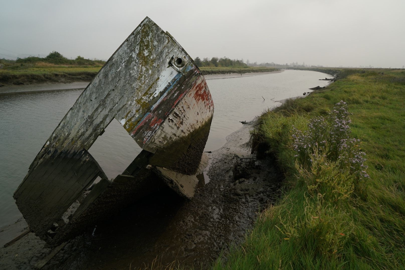
September 17th. No wind meant lingering smoke and by the following Thursday, after being cooped up for several days, Bruce grabbed the keys and said come on, we’re going for a drive. Dave had to work but Bruce and I headed in a loop, first stopping at Leque Island in the Skagit Wildlife Area to see the new wetlands created by bursting the dyke to flood the grasslands. The sun trying to break through the smoke, we didn’t expect to see much with such a sullied sky but were surprised. Shorebirds; Killdeer with its distinctive banded black chest…calling its name as it flies, Wilson’s Snipe, Western Sandpipers, Terns, and Gulls. Barn Swallows dipping above, Starlings, a huge Blue Heron who made a loud territorial bellow as he flew. Red Tailed Hawks, Canadian Geese honking overhead as they leave for winter; flocks of them heading out often with two leading the way like a scout party with another 20 following. Pretty Cedar Waxwings flitted in berry laden bushes at the edges and Sparrows pecked for insects hidden in the driftwood. A Kestrel sitting atop a dead tree eyeing the landscape. A big old boat discarded on the shore; colour faded, its timbers rotted and torn.
Buoyed by so many birds we drove for an hour to Deception Pass, Bruce talking up stunning views from the bridge above a river gorge. We arrived to a dense white fog obscuring everything within a few feet in front of us… laughing on the bridge…we couldn’t see a thing but the fog created a fantastic atmosphere.

We wandered on to the trail below, fog curling under the bridge, walking down to the pebble beach a short trail down. Fallen trees lay on the shore, their edges smoothed and rounded by passage through water or proximity to it. Bleached and stranded giants laid out to rest. Standing on the shore it was eerie, the lap of the river breaking on the pebbles but invisible until we walked right to its edge. I felt lucky to see Deception Pass like this; it was more suited to its name.

We walked back up the trail, spiderwebs hung glistening, the stone chimney of a picnic cabin emerged from the fog…and the trees, some with peeling bark, others marked with natural deep fissures, others hung with moss and lichens; jostling together to reach the sun….all soaring up in to a canopy of grey mist. It looked beautiful.
September 19th. The weekend came round; the smoke is finally clearing. Saturday, an overcast day but we got out of the house together, first to Edmunds Beach to pick along the shoreline looking for things of interest; ‘scratting on the beach’ as we used to say in Northern England, Mudlarking if on muddy river banks. I collected a handful of small driftwood pieces with a plan to make some handmade brushes for mark-making art projects. A Blue Heron perched on a buoy with a Cormorant alongside, stretching into an angular double V…drying his wings. Sea anemones clung sticky, curling in to themselves among the rocks. There were several divers, submerged in the cordoned diving area searching for fish.
Drove further out taking a scenic route towards Carnation in the Snoqualmie Valley, heading for the Tolt-MacDonald Park and suspension bridge. ing Company, the 500 foot long bridge gently sways when you get more than a couple of bodies walking it. Listed on the National Register of Historic Places it is a lovely thing built from creaking timber with scenic views across the Snoqualmie River.
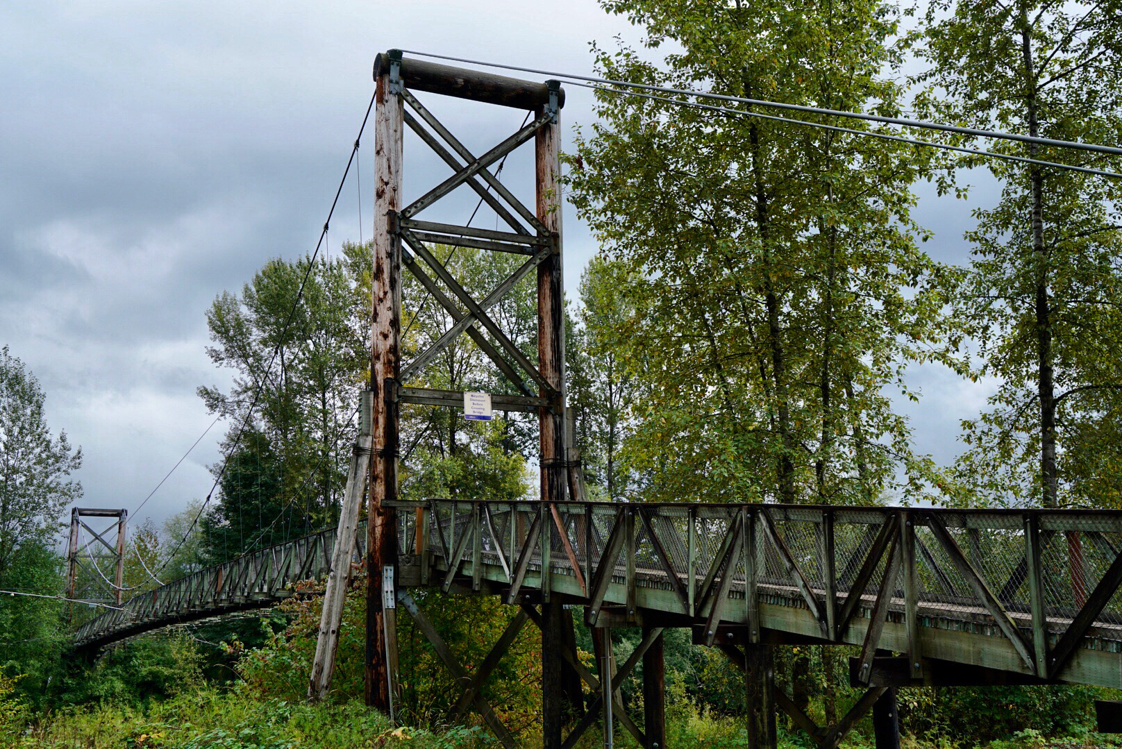

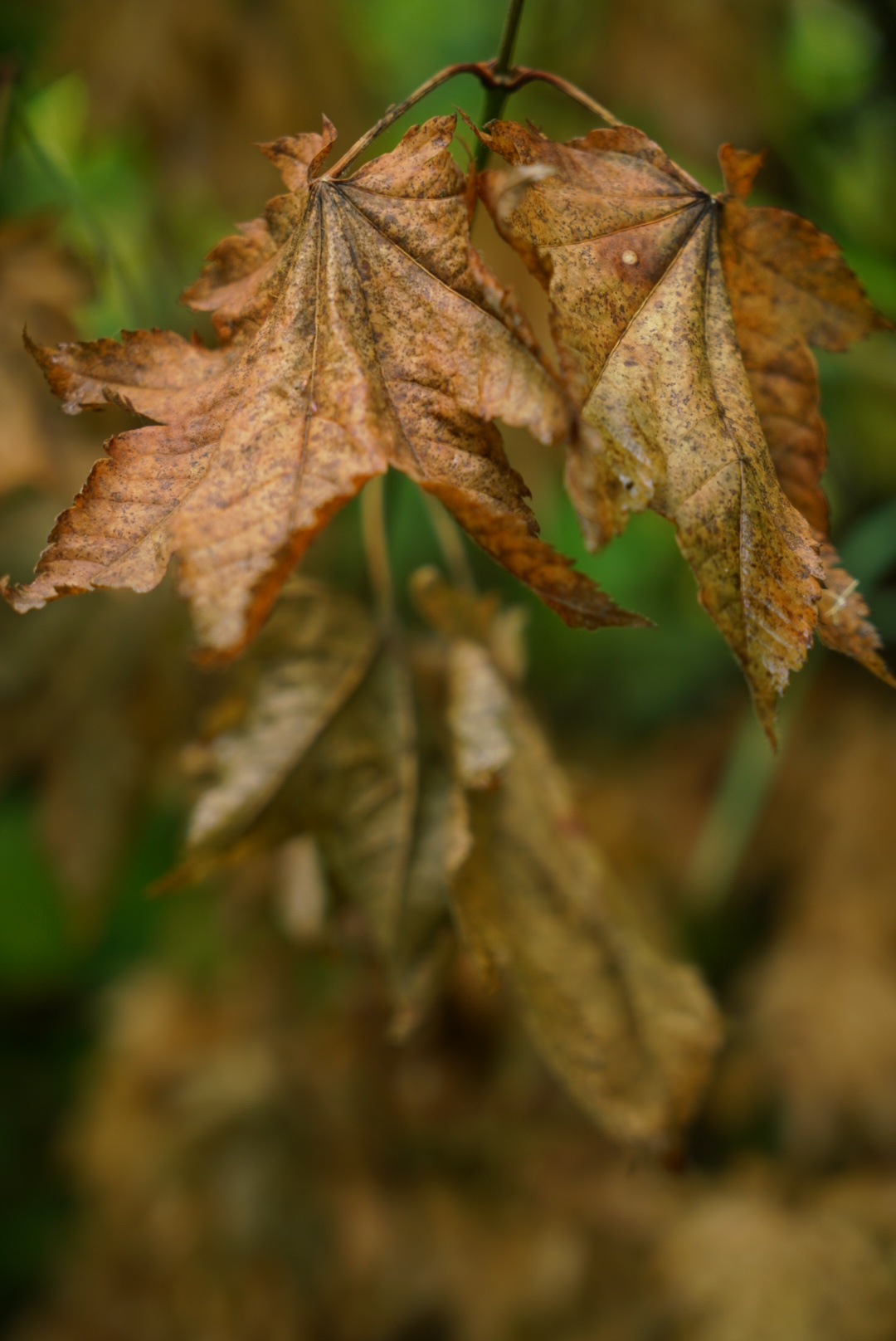
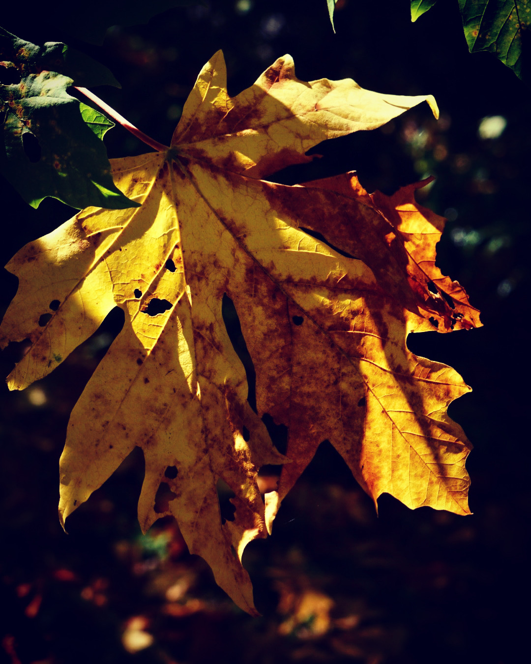
Across the other side there’s a campground with yurts and camping facilites; King County website gives camping and bike trail info: https://www.kingcounty.gov/services/parks-recreation/parks/parks-and-natural-lands/popular-parks/toltmacdonald.aspx We walked along the Cottonwood trail, stopping to look for birds, cutting through other smaller trails to the riverbank. I took lots of close up photographs. I love Autumn, the quiet, the stillness, the loamy smell of plants going back to the earth, retreating from view, folding inwards for winter. Bracken turning from green to gold to rust, blackberries, rosehips and snowberries show as bright flashes of colour, the last of the blueberries starting to turn whilst leaves twist slowly to the ground.

September 20th. Another trail another walk, around the nearby Magnuson park in Sandpoint, a 15 minute drive from Maple Leaf. We parked and Bruce stopped to point out two Barn Owl boxes above us. The former Sandpoint Naval Air Station in Seattle is now known as the Warren G Magnuson Public Park. It’s the home of 22 diving plane fins from 1960’s decommissioned United States Navy attack submarines known as ‘The Fin Project’ by artist John T. Young. From the Washington.edu website “The fins are arranged to simulate the dorsal fins of a large Orca whale pod or a school of salmon.” http://faculty.washington.edu/jtyoung/fins.html

We followed one of the trails through more Autumn colour and a bounty of bramble briars loaded with plump glistening blackberries. We wandered to the river’s edge to look out across Lake Washington; the sky a brilliant blue, the sun unexpectedly hot on our backs. A Hummingbird dived, blurred among the trees guarding his territory. Grasses were dry, turning to seed, bending in the breeze and a tiny snail shell and a Ladybird were held in the curl of a seedhead…to be able to spend enough weeks here that we could experience the turn of the seasons.


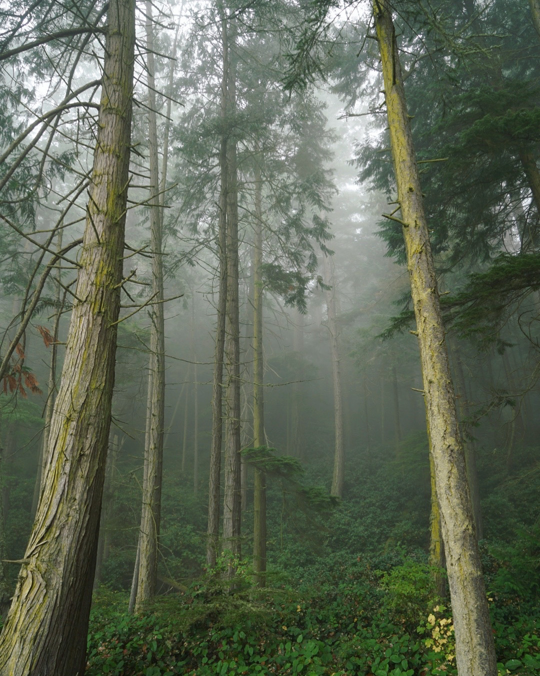
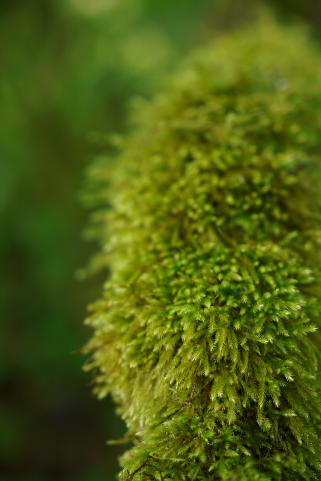
September 22nd. The rain has hit Seattle. We wanted to go to Rainier National Park and Dave booked a day off work, switching the days at last minute when we saw the icons on the weather app change from sun to lightning flashes and pelting rain. So on a cloudy Tuesday morning we drove 2 and a half hours to Paradise; Sunset had road closures due to the recent fires. Entering the park around 11am the sun was showing through the dense stand of trees, filtering down to reveal the rain soaked brilliant green lichens and mosses…creating a soft sprung natural carpet.

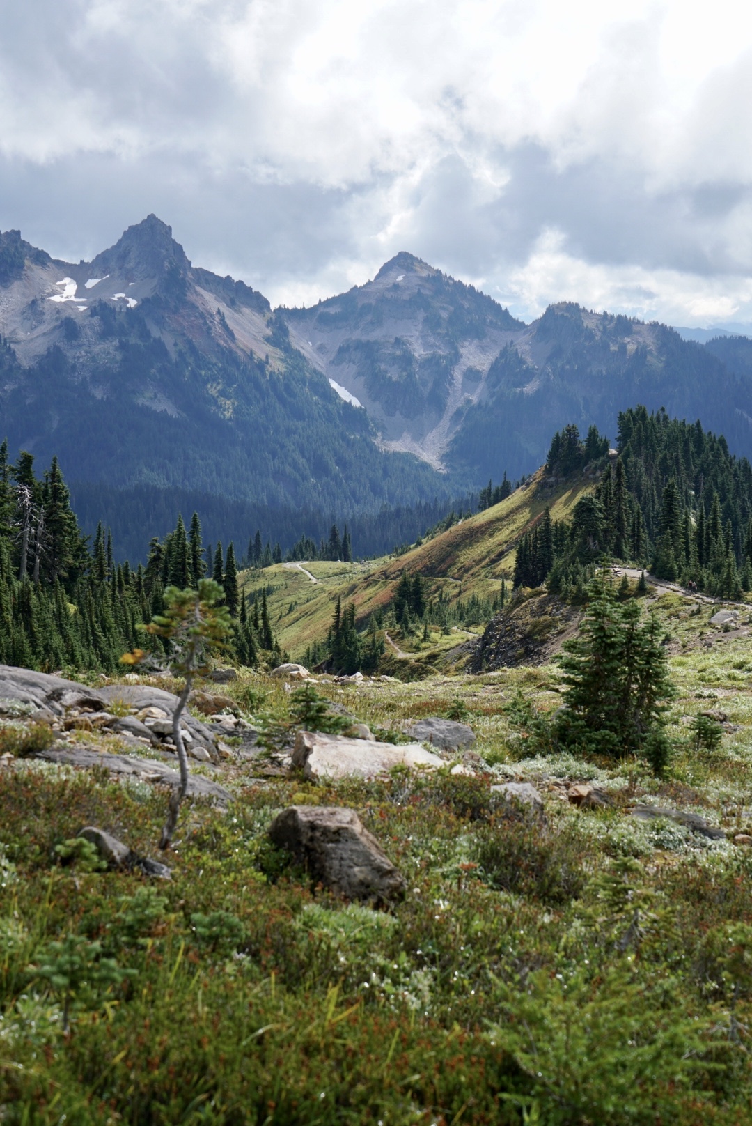
Driving higher to the parking at Sunset, we grabbed our packed lunches and started out on a trail heading up, not sure how far we’d go or how steep we’d climb. The sun broke out, warming us and dew glittered the trail edge from lupine leaves and autumn berries. Awed by the natural beauty, we stopped frequently, breathing it in, committing the alpine landscape to memory. I was completely floored by it.

The mountains were in low cloud but the higher we climbed the more they cleared, giving clear views across ridge lines, their jagged edges softened as the last remnants of cloud waited to disperse. The trail was moderately steep but easy underfoot, tarmacked, well maintained by the park. We stopped at a large boulder, sat on it to eat our sandwiches, goading each other, guessing how long it would take for the cloud to clear and reveal Mount Rainier. It would give us glimpses, one hole would open and we’d see a patch of glacier, another cloud rolled over… but then a glimpse of the snow capped peak…and it was a wondrous thing to see, Captivating. There’s not enough superlatives…seeing this looming volcanic mountain revealed in tiny snapshots, hidden before you grasp the vastness of it.

We reached the Glacier Vista, stumbling over hard loose rocks, plenty of other trail walkers already here, most masked, some not. Again, the peak hidden in cloud but the stark beauty of the glacier right in front of us, impossible to judge distances…surreal…like a huge painted backdrop; at any minute the wind would blow and lift it’s canvas edges and the Wizard of Oz trickery revealed to us.

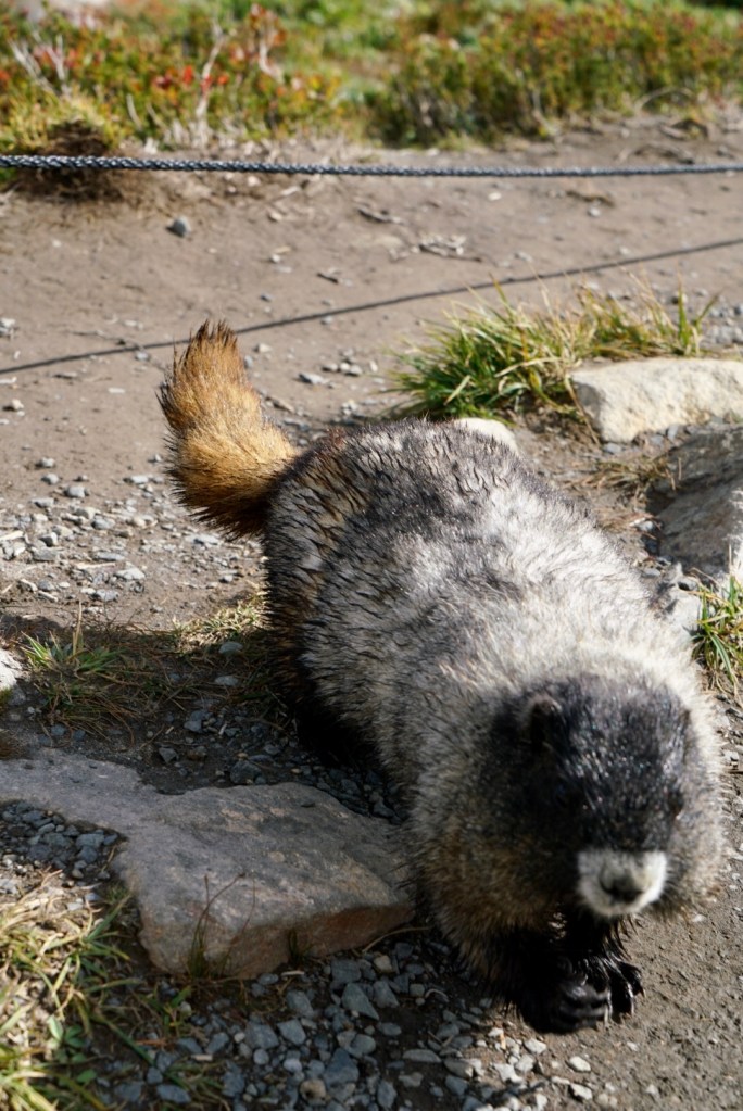
We’d seen a lot of marmots and on the descent one was so bold it came barrelling straight to us, Bruce balancing his scope to take a closer photo of this large body of fur, standing now on its back legs, expecting food. We didn’t feed it and warned a passing couple against it as she reached for a snack and he reached out his hand to stroke it. He pulled his hand back when we told them that it could bite pretty hard. Chipmunks skittered among the rocks and wildflowers, but also bold, used to trail walkers, most likely used to left over sandwiches. Marmots are herbivores, a large ground squirrel, fattening themselves up ready for hibernation in winter. Many of them were basking on rocks, lumbering the trails then surprising you with their agility by darting in and out of lookout burrows.
We started the long walk down. 4pm and the sun was lowering, the soft autumn richness of it reaching across the land, burnishing it in shades of copper, deep reds and gold. An overcast day had turned in to a glorious one and we breathed it in, enjoying the last gasp of summer.
And after 9 weeks we booked our flights back to New York, to face whatever autumn and winter was going to bring, proud that our adoptive city had turned around from being crushed by the virus to flattening the infection rate below 1%. The museums cautiously opening (at 25% normal capacity) and the election coming up in November. It’s going to be an interesting time. But thank god for this respite, to reconnect with Bruce, to walk maskless in wild forests, to experience the incredible natural landscapes of Washington State, Idaho and Montana, to see our Seattle friends after such a long time. Quite unexpectedly and despite our surreal new world, we’d had an incredible summer.
